10 Humongous Mountains In San Francisco That’ll Help You Achieve Your Hiking Goals!
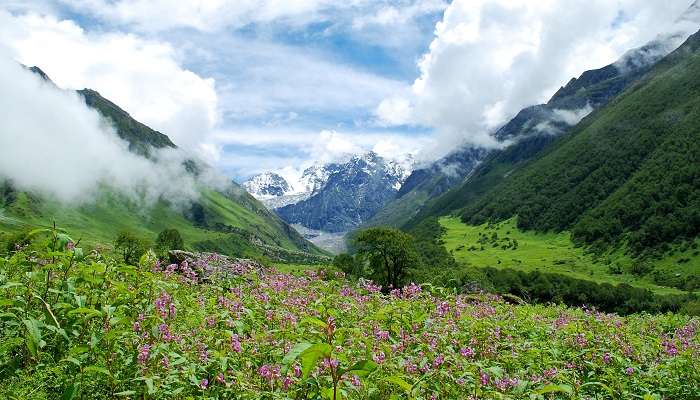
The mountains in San Francisco are mostly located in the Bay area and some just by the city. The ones in the Bay area has world class trails and is a paradise for a trail enthusiast, veteran trail runners, and outdoor-loving families. The views are stunning and includes the vistas of the Pacific. There is a good chance to spot some wildlife as well as marine life like whales in the trails and beaches respectively. And the ones by the city are relatively easier to climb and are shorter and they offer amazing city views.
10 Top Mountains In San Francisco
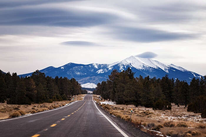
Lace up as here is the interesting list of the mountains in San Francisco that adds up as a splendid hike and a great picnic spot as well. It would be a good idea to do some San Francisco peak camping as well. The locations allow for mountain biking in San Francisco and also mountains in Arizona, San Francisco have also been included in our list.
1. Land’s End
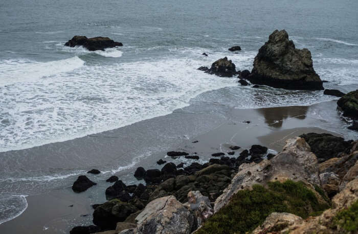
This is the rocky northwestern corner of San Francisco and a hike about 4 miles by the cliffs that gives you unimaginably beautiful views is present. The winding trails are well maintained and are suitable for new hikers. Tourists can be seen in oodles during the weekends and weekdays are when you can feel one with the place. The views from here cover the Golden Gate Bridge, China Beach, Marin headlands and the Ocean. And when the tide is low you will get to view the remains of shipwrecks. Once done, you can head over to the Cliff house for a chilled beer or a cocktail.
Location: 680 Point Lobos Avenue, San Francisco.
Must Read: 10 Brilliant Day Trips From San Francisco That You Can Take With Your Globetrotter Buddies In 2022
Looking To Book An International Holiday?
Book memorable holidays on TravelTriangle with 650+ verified travel agents for 65+ domestic and international destinations.
2. Angel Island
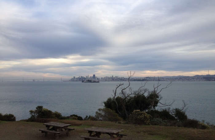
This hike on Mount Livermore is 4.6 miles long and the highest point being 788ft. The views from here cover the Bay Bridge, Golden Gate, Alcatraz and the Skyline of San Francisco. The blue ferry or the golden ferry from Pier 41 takes you to the island. Once there you can start with this relatively easy hike and you can pack a picnic as well to keep the hunger at check.
Location: Angel Island, San Francisco Bay.
3. Mount Diablo
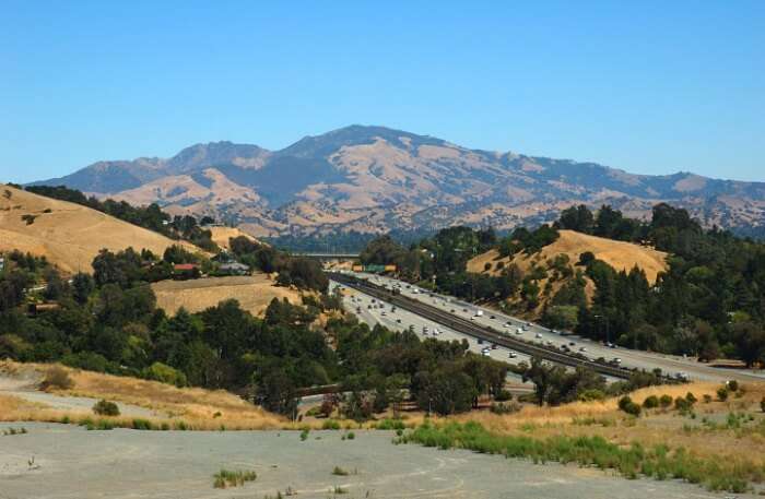
The Mount Diablo has an altitude of 3849 feet and is one of the tallest in the Bay area. The good altitude means comparatively better views, what it also means is 6.1 miles of work to reach the peak. When on top you will get a bird’s eye view of the San Francisco Bay area and on a very clear day you will also get to see the Farallon Islands, Mount Lassen and Sierra Nevadas. It is advisable to wear hiking boots or outdoor shoes for better grip as the hike gets steep in certain parts. Carry water and eatables as you will find a lot of shade to stop and relax.
Location: Mount Diablo, Contra Costa County.
Suggested Read: 10 Beautiful Places To Visit In San Francisco That Ought To Be On Your Itinerary
4. Mount Tamalpais
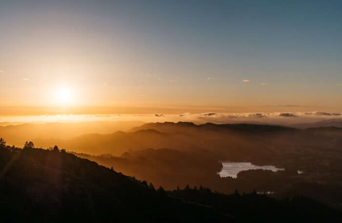
This is a short hike of 1.2 miles and the mountain is about 2570 feet high. It is super easy to get to and gives splendid views of the Northern Marin, the East Bay and San Francisco. You can spend a good time here watching the views. This place is a treat when you are on the top during sunset.
Location: Mount Tamalpais, Marin County.
Planning your holiday but confused about where to go? These travel stories help you find your best trip ever!
Real travel stories. Real stays. Handy tips to help you make the right choice.
5. Dipsea Trail
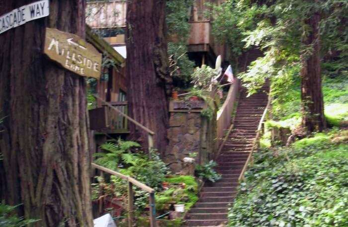
This is a long hike of 9.5 miles starting from the Mill Valley, ending at Stinson beach. This is not a hike for beginners and is more than moderate in terms of difficulty. The views are amazing and covers the Golden Gate, the Bay side, Mt. Tam, Stinson Beach, redwood trees and the Pacific Ocean. If lucky you will also spot some wildlife on the trail. The Dipsea Stairs across the creek allows you to experience the Steep Ravine. For this long hike it is advisable to carry a lot of water and you can have lunch later at Stinson beach. If this hike seems to long to you then you can opt for the shorter hike which is about 7.5 miles long and starts at Stinson.
Location: Dipsea Trail, Mill Valley, California.
Suggested Read: San Francisco Nightlife: Best Places To Eat, Drink, Dance, And Repeat!
6. Alamere Falls
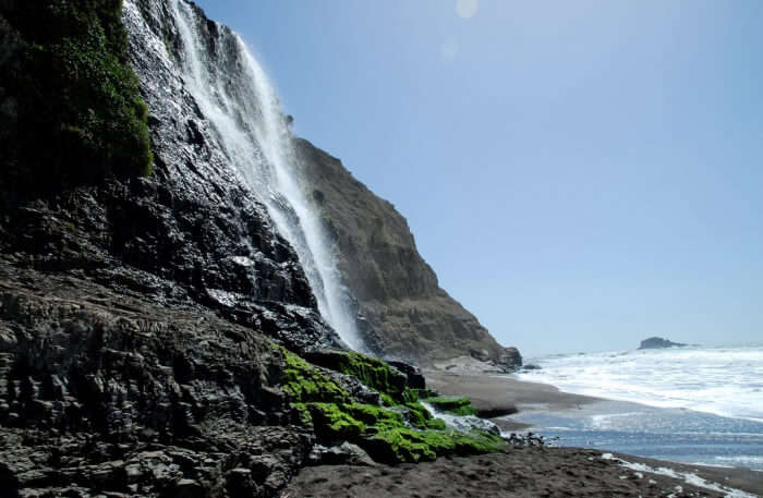
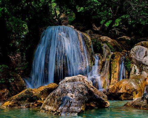
This is a 7.5 mile long hike that has a 40 feet tall cascading waterfall. The waterfall cascades down a cliff heading directly onto the beach. The massive waterfall is the main highlight here and along with it you get to enjoy the breathtaking views. This hike is a bit intense and there are a couple of steep parts and the trail gets crowded at times yet is totally worth it. Do pack a swimsuit if you intend to stop by Bass Lake as this will turn up as a tempting spot to swim for swimming lovers.
Location: Alamere Falls, Point Reyes National Seashore.
7. Windy Hill Open Space Reserve
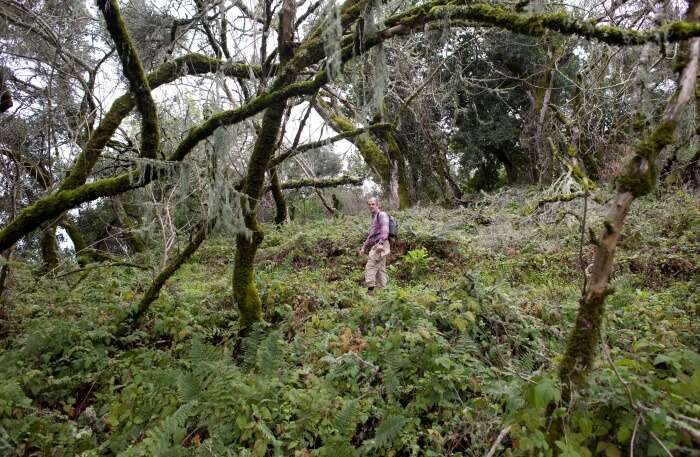
This is a short hike of 1.3 miles. This is a place to go when you want excellent views without a lot of effort. The area is of 1335 acres in size. Huge Grassland ridges like this are hard tp find and the Anniversary trail here has 360 degree views of the ocean to the San Francisco Bay area. As this is a windy place it would be thoughtful to wear a jacket or carry one.
Location: San Mateo County.
Suggested Read: San Francisco Shopping 2022: 10 Places That’ll Help You Pamper Your Heart & Upgrade Your Style
8. Tennessee Valley
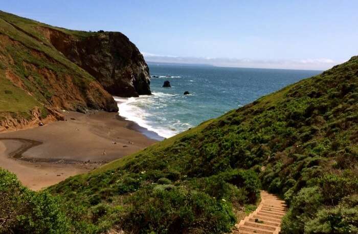
This hike is 3.4 miles long and is relatively easy and popular. The fact that the trails are somewhat flat with less hills and more views. The trail winds the coastal hills and once done you end up in a sandy beach, a tiny one that is between bluffs on both sides. On looking carefully you fill find the hole in the black rock cliffs which has been made by the ocean waves. Pets aren’t allowed on the trail but you will find a lot of horses and some stables on the path.
Location: Tennessee Valley, Marin County.
9. Mount Davidson
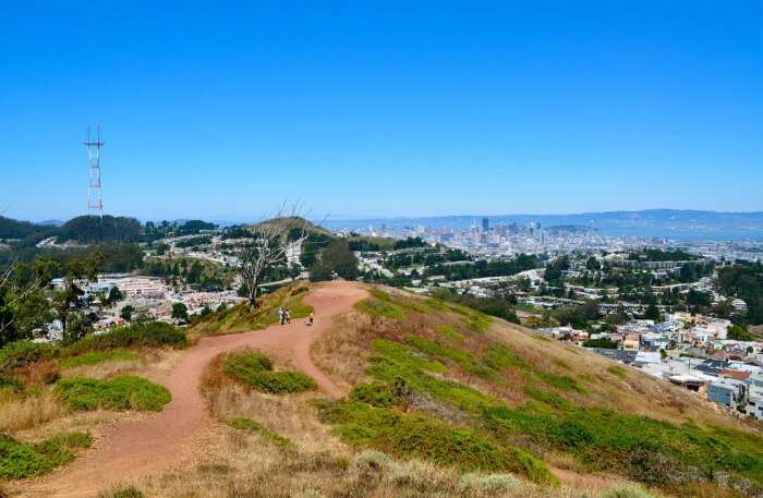
The peak is about 938 feet high and is the highest peak in San Francisco, USA. Tour buses and visitors are seen constantly moving on the slopes. The outdoor lovers that visit here love the routes that go through the urban oasis in solitude. You can easily access the trails that encircles the hill. You can easily find an ideal spot to stop and enjoy the city view from there. The most ideal spot would be the 103 feet cross erected during the Great Depression in 1934, from where you can have a splendid view of the city below.
Location: Mount Davidson, San Francisco.
Suggested Read: 9 Best Casinos In San Francisco Which One Must Definitely Visit And Play A Game Of Poker!
10. Claremont Canyon Regional Preserve
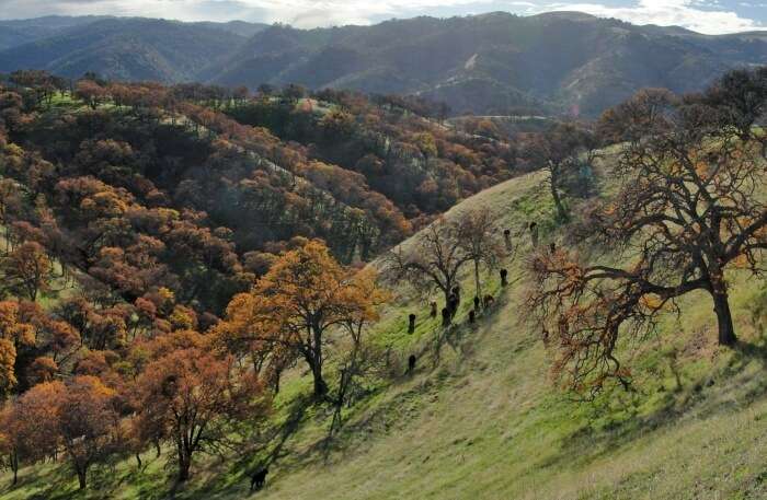
The Claremont Canyon Regional Preserve is a 208 acre area behind the Claremont hotel with scenic hiking trails, the hike distance here is 3.2 miles. You can take the primary trail, the Stonewall Panoramic trail. This trails takes you on a good elevation of 700 feet which is totally worth it and give you stunning views of Berkeley Hills, Downtown Oakland, Downtown Berkeley and the San Francisco Bay.
Location: Claremont Ave, Berkeley.
Further Read: San Francisco In December: An Ultimate Guide To Witness The Snowy Magic & Charm In The City
So these were the top ten trails that you can hike in the mountains of San Francisco. Be it for the stunning views with a small picnic or just trail exploration, these places will certainly give you the best experience of the mountains in San Francisco. So, don’t wait anymore and book your trip to San Francisco right away!
Looking To Book A Holiday Package?
Book memorable holidays on TravelTriangle with 650+ verified travel agents for 65+ domestic and international destinations.

Exploring new places and trying out new food cuisines are two things that bring Seema all the happiness. Travel freak and a die-hard foodie are the synonyms that define her the best. Popular on social media by the name of ‘PandaReviewz’, lazing around the beaches, exploiting the sunset points, visiting the farthermost villages, exploring the renowned cities, trying out new food cuisines, and blogging about them are few things that keep Seema occupied, and happy!

