4D / 3N
17% OFF
4D / 3N
17% OFF
Manali-Kasol Tour Package by Cab for Himachal (4D/3N) - At A Glance
- Hotel
- Meals
- Sightseeing
- Entry Tickets
- Cab Transfer
₹12,688
₹10,500 /pp
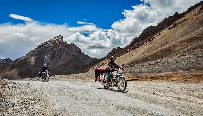


The Manali to Leh road trip covers about 475 km across the Indian Himalayas and takes most travellers 2 to 3 days, with the highway open roughly from late May or June to early October. You climb from Manali at 2,050 m to Leh at 3,500 m, crossing four high passes and the 9 km Atal Tunnel on the way. This guide gives you the exact route and distances, a day-wise itinerary built around acclimatization, where the last fuel and ATM sit before Leh, the permits you actually need as an Indian or foreign traveller, and how to handle altitude on one of the highest drivable roads on earth. Everything below reflects the 2026 driving season.
Manali to Leh road trip
Best Time
June - September
Select Package Type

3 Days & 2 Nights
₹9,043 /@pp
GET FREE QUOTE

.jpg?tr=w-600,h-300)

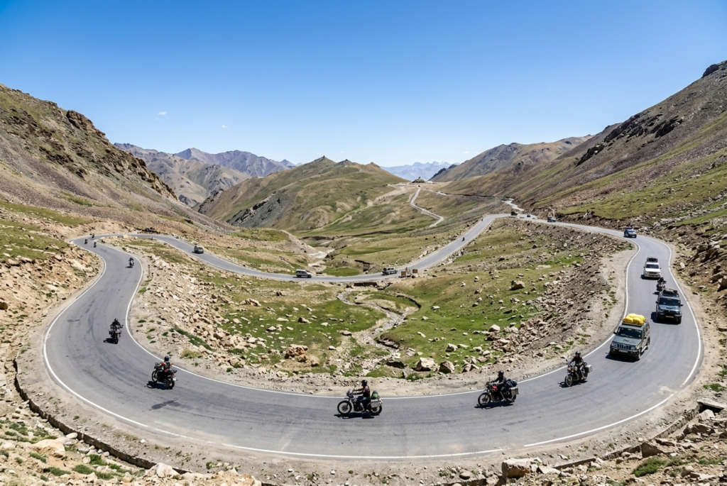
The Manali-Leh Highway is a seasonal road. The Border Roads Organisation (BRO) clears it around late May or June once the winter snow melts off the passes, and it stays open until the first heavy snowfall closes them, usually by around November. For the 2026 season the highway connected up in mid-May and is open. Aim for June to September if you want the firmest road surface and the most predictable weather. Always check the live road status a day or two before you leave, because a single storm can shut Baralacha La or Tanglang La with little warning.
| Month | Daytime temperature | What to expect on the road |
|---|---|---|
| June | 10 C to 20 C | Passes freshly cleared, snow walls and slush near Baralacha and Tanglang La |
| July to August | 15 C to 25 C | Warmest and busiest. Watch for flash floods and landslides after rain |
| September | 5 C to 18 C | Clear skies, thinner crowds, cold nights. The connoisseur’s month |
| October | Below 5 C | Season winding down. Passes can close with no notice |
Winter travel is not an option. From around November the highway is officially closed and the high passes lie under several feet of snow until the BRO reopens them the following summer.
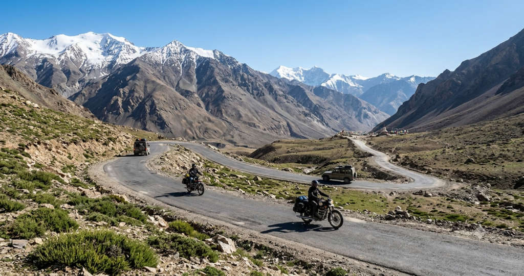
By road it is roughly 475 km from Manali to Leh, and the drive takes 2 to 3 days because you are gaining serious altitude and need to stop to acclimatize, not because the distance itself is huge. The classic route runs Manali, Atal Tunnel, Keylong, Jispa, Baralacha La, Sarchu, Pang, Tanglang La, Upshi and into Leh. Since the 9.02 km Atal Tunnel opened in October 2020, most drivers skip the old climb over Rohtang Pass entirely. The tunnel drops you at Sissu in the Lahaul valley in about an hour, which shortens the first leg and takes the notorious Rohtang traffic out of the equation.
| Route segment | Distance | Approx driving time |
|---|---|---|
| Manali to Sissu (via Atal Tunnel) | ~37 km | 1 to 1.5 hours |
| Sissu to Keylong | ~62 km | 2 hours |
| Keylong to Jispa | 23 km | 45 minutes |
| Jispa to Baralacha La | 50 km | 2 hours |
| Baralacha La to Sarchu | 42 km | 1.5 hours |
| Sarchu to Pang | 80 km | 3 hours |
| Pang to Tanglang La | 84 km | 3 to 4 hours |
| Tanglang La to Upshi | 77 km | 2 hours |
| Upshi to Leh | 46 km | 1 hour |
If you take the older road over Rohtang Pass (51 km, 2 to 3 hours) for the views, add time and carry the Rohtang permit. For the through-drive to Leh, the Atal Tunnel line is faster and simpler.
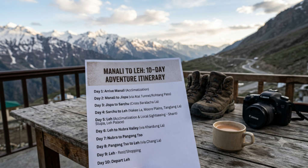
A three-day plan is the safe way to do this drive. It breaks the altitude gain into stages and gives your body a night to adjust before you cross the highest passes. Strong, experienced groups compress it into two days, but the extra night at Jispa or Sarchu is what keeps altitude sickness off your trip.
| Day | Route | Distance | Overnight | Altitude |
|---|---|---|---|---|
| Day 1 | Manali to Jispa via Atal Tunnel, Sissu, Keylong | ~135 km | Jispa (3,200 m) | 2,050 to 3,200 m |
| Day 2 | Jispa to Sarchu via Darcha, Zing Zing Bar, Baralacha La, Suraj Tal | ~90 km | Sarchu (4,290 m) | up to 4,890 m at Baralacha La |
| Day 3 | Sarchu to Leh via Gata Loops, Nakee La, Lachulung La, Pang, More Plains, Tanglang La, Upshi | ~250 km | Leh (3,500 m) | up to 5,328 m at Tanglang La |
Leave Manali early. Clear the Atal Tunnel before the day-tripper crowds, stop for photos at Sissu waterfall, and roll through Keylong, the district headquarters of Lahaul. Jispa, a small riverside village 23 km further on, makes the ideal first night at 3,200 m. Use the afternoon to rest rather than push on. This gentle first gain is exactly what an easy acclimatization schedule needs.
This is the day the landscape turns raw. Past Darcha the greenery fades, and you climb through Zing Zing Bar to Baralacha La at 4,890 m, with Suraj Tal lake just below the pass. Drop to Sarchu at 4,290 m for the night. Sarchu sits on the Himachal-Ladakh boundary in tented camps, and it is the spot where altitude headaches most often show up, so hydrate hard and turn in early.
The long final day. Climb the 21 hairpin bends of the Gata Loops, cross Nakee La and Lachulung La, then reach Pang and the strange flat expanse of the More Plains. Tanglang La at about 5,328 m is the roof of the drive before the road eases down through Upshi and Karu into Leh. Arrive with daylight to spare, check into your hotel and rest. Do not plan anything strenuous on your first evening in Leh.
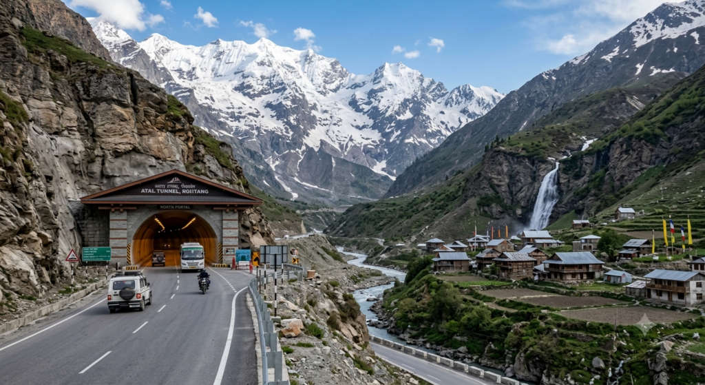
Between Manali and Leh the road strings together a run of landmarks that are worth knowing by name, both for navigation and for the sheer variety of terrain.
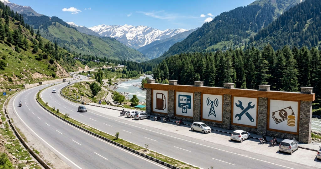
This is the section that separates a smooth drive from a stranded one. Beyond Keylong there is very little infrastructure, so plan your fuel, cash and connectivity before you leave the valley.
| What you need | Where to sort it | The detail that matters |
|---|---|---|
| Fuel | Tandi (last pump), then Karu | Tandi to Karu is about 365 km with no reliable fuel. Fill up at Tandi and carry a spare 5 to 10 litre can. |
| Cash / ATM | Keylong (last reliable ATM) | Carry enough cash for 3 days of dhabas, camps and permits. Past Keylong it is effectively cash only. |
| Mobile network | Postpaid SIM only (BSNL, Jio, Airtel) | Prepaid SIMs from other states do not work in J&K and Ladakh. Expect no signal across most of the highway. |
| Mechanics | Manali, Keylong, Tandi, Sarchu, Pang, Upshi, Karu, Leh | Sparse and basic. Carry a spare tyre, a puncture kit and a tow rope. Service the vehicle before you start. |
| Food and water | Keylong, Jispa, Darcha, Sarchu, Pang dhabas | Mostly seasonal parachute-tent dhabas. Carry extra water, snacks and any special medication. |
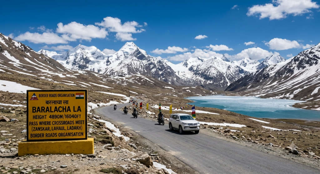
Acute Mountain Sickness is the single biggest health risk on this trip, and it does not care how fit you are. The good news is that the Manali route ascends gradually, which gives your body more time to adjust than flying straight into Leh does. Follow the altitude ladder and most people are fine.
| Point on the route | Altitude | Note |
|---|---|---|
| Manali | 2,050 m | Start |
| Atal Tunnel / Sissu | ~3,120 m | First real gain |
| Keylong / Jispa | 3,080 to 3,200 m | Good first-night halt |
| Baralacha La | 4,890 m | Cross it, do not linger |
| Sarchu | 4,290 m | AMS most common on this overnight |
| Tanglang La | ~5,328 m | Highest point of the drive |
| Leh | 3,500 m | Rest a full day on arrival |
Watch for headache, nausea, dizziness and breathlessness. Drink 3 to 4 litres of water a day, skip alcohol for the first two days, and never climb higher to sleep if symptoms are building. Many travellers take Diamox as a preventive, but start it only after speaking to a doctor. If symptoms turn severe, confusion, a bad cough or trouble breathing, descend immediately. That is the one rule that matters more than any other up here.
There is no single right way to reach Leh from Manali. Your choice comes down to how much control you want, your budget and how comfortable you are at altitude. The costs below are indicative for the 2026 season and worth confirming when you book.
| Option | Rough cost | Best for | Watch out for |
|---|---|---|---|
| Self-drive (own or rented SUV) | Fuel plus rental | Groups of 4 to 6 who want control and luggage space | Engine strain at altitude, rough surfaces, you fix your own trouble |
| Rented Royal Enfield from Manali | ~Rs 1,500 to 2,000 per day | Bikers chasing the classic ride | Cold, fatigue and no backup if the bike breaks down |
| Shared cab or taxi union | Per-seat or per-car union rate | Travellers who want zero driving stress and local know-how | Fixed schedule and rigid union pricing |
| HRTC or HPTDC bus | Budget seat fare | Solo and budget travellers | A hard 2-day ride, basic comfort, seasonal service only |
| Booked tour package | All-inclusive per person | Anyone who wants the logistics handled | Less day-to-day flexibility |
If you would rather leave the driving, permits and hotels to someone else, TravelTriangle’s Himachal tour packages range lets you build a custom Ladakh trip from Manali end to end.
Permit rules trip up a lot of first-timers, so here is what actually applies as of the 2026 season.
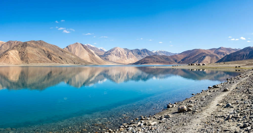
Once you have rested in Leh, these are the trips most travellers build their extra days around. Each of the branch destinations below needs the Ladakh Environment & Development Fee permit for Indians and a Protected Area Permit for foreigners.
Base yourself in Leh (3,500 m) for a day of easy sightseeing. The nine-storey Leh Palace looks over the old town, and Thiksey and Hemis, two of Ladakh’s most important monasteries, sit a short drive away. The market is the place to sort SIMs, cash and permits before you head out again.
The 134 km long lake at 4,350 m shifts through blues and greens as the light changes, and it reaches across the border into Tibet. It shot to fame after the film 3 Idiots and is now the most popular overnight branch trip from Leh. You cross Chang La, a pass at about 5,360 m, to get there.
Reached over Khardung La, Nubra is a wide desert valley where the Shyok and Nubra rivers meet. The draw is the double-humped Bactrian camels on the Hunder sand dunes, an odd sight against the snow peaks. Diskit monastery and its giant Maitreya Buddha statue anchor the valley.
Far quieter than Pangong, Tso Moriri (4,522 m) sits deep in the Changthang plateau and draws birdwatchers and travellers after real solitude. The drive passes nomadic Changpa herders and their pashmina goats.
One of the world’s highest motorable passes at about 5,359 m, Khardung La is the gateway to Nubra and a bucket-list ride in its own right. Keep the stop short, the air is thin and lingering invites a headache.
If you are starting from a blank page, work through these six steps in order and the trip more or less plans itself.
The Manali to Leh drive is remote, high and cold even in summer, so pack for it deliberately rather than throwing a bag together the night before.
On the road itself, drive slowly on the mountain sections and never at night, keep your speed down on steep curves, and check the weather and highway status each morning. If the road ahead is reported blocked, wait it out. These passes do not reward hurrying.
The Manali to Leh road trip earns its reputation. In three days you cross four Himalayan passes, watch green valleys give way to cold desert, and arrive somewhere that feels like the edge of the map. Plan it around the season and the altitude, respect the fuel and cash gaps, and it rewards you like few drives on earth.
When you are ready to turn the plan into a trip, browse TravelTriangle’s Himachal tour packages or read the full Ladakh travel guide for everything to do once you reach Leh.
The highway is a seasonal road, open roughly from late May or June to around November, depending on snowfall. During those months it is generally open, though single passes like Baralacha La or Tanglang La can close for a day after a storm. Always check the live BRO road status a day or two before you travel, as conditions change quickly at this altitude.
It is about 475 km by road and takes 2 to 3 days to drive. The time is dictated by altitude, not distance. You climb from 2,050 m in Manali to over 5,300 m at Tanglang La, so you need overnight halts at places like Jispa and Sarchu to let your body acclimatize rather than pushing straight through.
Two days is the practical minimum for fit, experienced travellers who split the drive at Sarchu. Three days is far safer and more enjoyable, with nights at Jispa and Sarchu that ease the altitude gain. Add two or three more days in and around Leh if you want to see Pangong, Nubra or Tso Moriri.
Yes, thousands do it every season, but only with preparation. You need a well-serviced high-clearance vehicle, a spare tyre and fuel can, cash, and a sensible acclimatization plan. Drive in daylight only, avoid the passes right after heavy rain or snow, and do not attempt water crossings you cannot read. The terrain is unforgiving of shortcuts.
No permit is needed for the main Manali to Leh highway itself. You only need to pay the Ladakh Environment & Development Fee and carry the permit once you branch off to restricted areas such as Nubra Valley, Pangong Lake or Tso Moriri, which you can arrange online or at the DC Office in Leh. The old Rohtang Pass permit applies only if you drive over Rohtang rather than through the Atal Tunnel.
Tandi, near Keylong, has the last reliable petrol pump. The next dependable fuel is at Karu, about 36 km before Leh, which leaves a roughly 365 km gap, so fill up and carry a spare can. Keylong has the last reliable ATM. Beyond it, the highway is effectively cash only, so draw what you will need for three days.
June to September is the sweet spot. June brings freshly cleared passes and snow walls, July and August are the warmest and busiest but carry a landslide risk after rain, and September offers clear skies, thinner crowds and cold nights. From around November the highway is closed for winter and does not reopen until the following summer.
The classic five are Rohtang Pass, Baralacha La, Nakee La, Lachulung La and Tanglang La. If you take the Atal Tunnel you bypass Rohtang, so the four you actually cross on the tunnel route are Baralacha La (4,890 m), Nakee La, Lachulung La and Tanglang La (about 5,328 m), the highest point of the drive.
Chang La, at roughly 5,360 m, is the high pass you cross on the road from Leh to Pangong Lake. It is one of the highest motorable passes in the world. Keep your stop at the top short, since the thin air brings on altitude symptoms fast if you linger.
Warm layers, a windproof jacket, gloves and a cap for freezing nights, plus strong sun protection for the fierce high-altitude UV. Carry a medical kit with rehydration salts and any personal medicines, three days of cash, printed permit and ID copies, a power bank, and vehicle spares including a tyre and puncture kit. Water and snacks matter too, since supplies thin out past Keylong.
It varies widely with your style of travel. A shared self-drive or bike trip split across a group can work out to roughly Rs 15,000 to 30,000 per person for the Manali to Leh leg, covering fuel or rental, food, camps and permits. A fully organised package costs more but removes all the logistics. Confirm current-season rates when you book, as fuel and rental prices shift year to year.
Real reviews from real travelers who booked with us.
View All Reviews