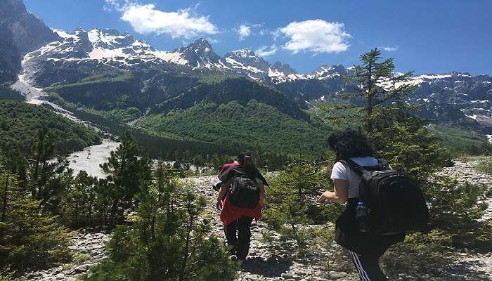
An Adventurous Himalayan Journey To The Satopanth Tal

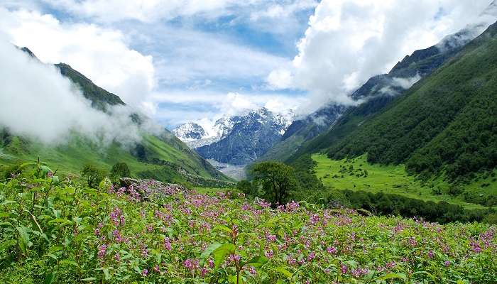
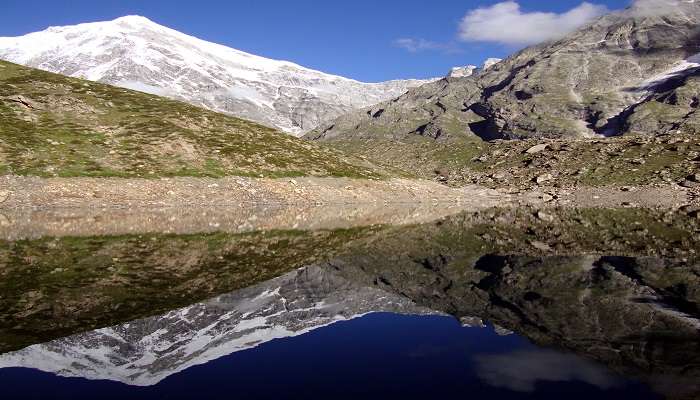
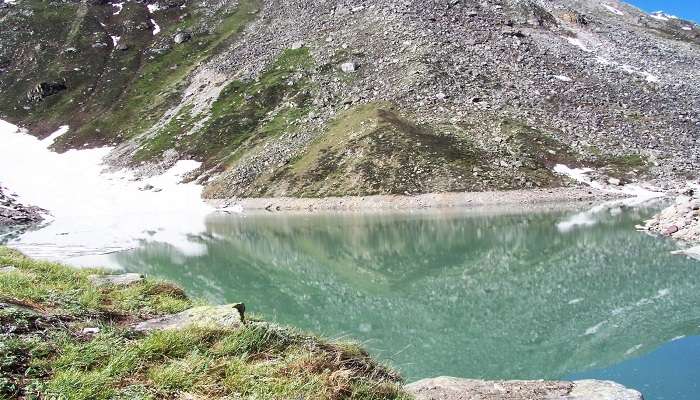
Satopanth Tal is an untouched glacier lake located in the Garhwal Himalayas. The journey to this crystal clear emerald lake begins with a trek from Mana- the last village near the Indo-China border. The triangle-shaped lake is surrounded by snow-clad mountains on all sides and is one kilometre in perimeter. This lake is one of the biggest lakes formed by the Alkapuri Glacier. While the trek to the Satopanth Tal is a go-to for adventure lovers, it also holds impeccable religious significance to the locals. If you are a Himalayan lover and a person who wouldn’t miss a chance to dip your feet into any waterbody, this high-altitude alpine lake is a must-trek destination.
Planning An Unforgettable Trek To The Scenic Satopanth Tal
There are a few things to remember so you can enjoy your scenic and wonderful trek to the Satopanth Tal. Here are some informative pointers.
The Legend of the Satopanth Tal
The name “Satopanth” has a special meaning behind it. “Sat-o” in traditional Sanskrit means “Of truth”, and “Panth” means “Pathway”. So ‘Satopanth’ means “the pathway towards the ultimate truth”. The lake resembles a triangular shape, and legend says each of the three corners of Satopanth Lake is presided by one of the Universal Holy Trinity of Hindu Dharma. Brahma, the creator; Vishnu, the preserver; and Shiva, the destroyer, are believed to meditate at three corners and chart the course of the cosmos towards the Greater Good.
Locals from the Mana village believe that the Trimurti take a holy dip in the water on the lunar day of every Ekadashi. Therefore, the lake’s water is sacred and is considered by the Mana village inhabitants as a resting place for their dead. After someone passes away and their corpses are cremated, the villagers scatter their ashes in the water of Satopanth Lake.
Must Read: Trekking In Uttarakhand
Best Time to Trek to Satopanth Tal
Although the Satopanth trip is beautiful all year round, the best times to visit are in the summer (May to mid-July) and after the monsoon (September to October).
- Summer (May to mid-July): Mt. Chaukhamba, Mt. Swargarohini, and Mt. Neelkanth are visible under clear skies. Trekkers can enjoy moderate temperatures ranging from 12°C during the day to -5°C at night and blossoming alpine flowers. Wearing warm clothing is vital on chilly evenings.
- Post-Monsoon (September to October): enjoy the hues of fall and clear skies. Satopanth tal in October is mesmerising, with the onset of snowfall covering the landscape in a blanket of white. Daytime temperatures range from 5°C to -15°C. Don’t forget to wear thick, thermal clothing.
Monsoons and Winters are not recommended due to heavy rainfall, landslides, and extreme cold, making the trail inaccessible.
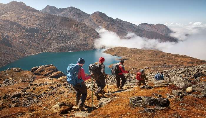
Here’s A Best Suggested Itinerary For The Trek To Satopanth Tal
The trek to Satopanth Tal takes approximately 5 days to complete. Below is a rough timeline of what to expect on your trek.
Day 1: Arrive At Badrinath
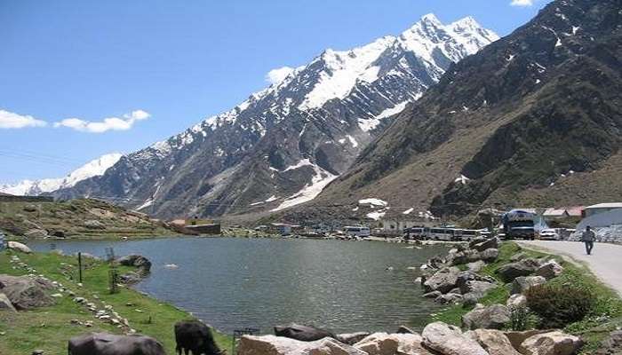
Acclimatising to the high-altitude weather will take you a day or more, so arrive at Badrinath early. Visit the Badrinath Temple and learn about its history. Stroll to the Mana Village, the last village on the Indo-Tibetan border. You can get your ILP (Inner Line Permit) from Joshimath because it is compulsory.
Suggested Read: Delhi To Spiti Valley Road Trip
Day 2: Badrinath To Lakshmi Vann
Begin a short 3 km trek to Mana village. After getting your permits checked, make your way to Vasundhara Falls. Tread through the forests of Lakshmi Vann and walk 3km further on the moraines, and you’ll reach the Laxmi Vann campsite.
Distance: 9 km
Duration: 4-5 hours
Day 3: Laxmi Vann To Chakratirtha
The trek may get tricky since the altitude gain is more than 2000ft, but the route becomes scenic as you enter Satopanth Valley. The trail continues along the banks of the Alaknanda River. Ensure you reach the campsite as early as possible, as the weather becomes unpredictable at a higher altitude after noon.
Distance: 7 km
Duration: 3-4 hours
Suggested Read: Trekking Near Dharamshala
Day 4: Chakrateertha To Satopanth Tal And Back To Chakrateertha
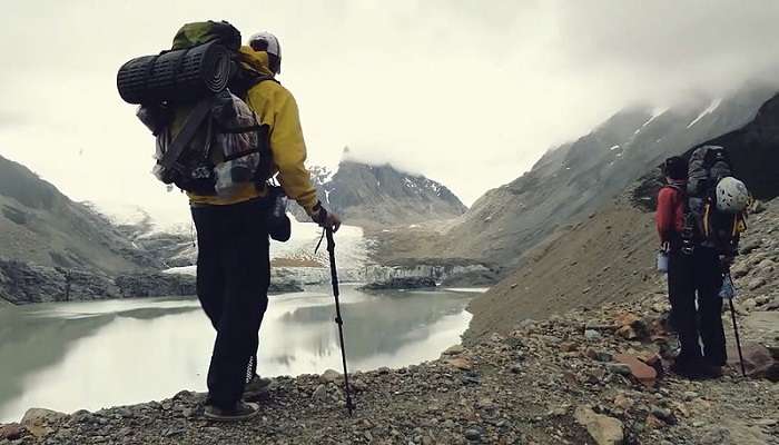
The initial trail from Chakrateertha is pretty flat, and you trek on the grassland. After 2 km of the trek, the trail mazes through boulders and moraine. You need to trek very carefully. Take the help of a trekking pole here. You will get the first view of the Satopanth Tal only when you reach the top of the ridge. From there, you can see the triangular Satopanth Lake. If the weather is clear, you can see something interesting. You can see three out of seven steps on the Swargarohini glacier, which is believed to be the path to heaven that Pandavas took. After spending some time here, head back to Chakrateertha.
Distance: 10 km (5+5)
Duration: 8 hours
Day 5: Chakrateertha To Badrinath
Take the same trail taken to reach Chakrateertha from Lakshmi van and again from Mana to Lakshmi van. It will take you around 5 to 6 hours to reach Mana village. If you are too tired to walk up until Badrinath, you can hire a jeep or taxi from Mana village.
Distance: 15 km
Duration: 5 – 6 hours
Suggested Read: Places To Visit In Badrinath
How To Reach Satopanth Tal Trek
The Satopanth Trek starts at Mana Village in Uttarakhand. It is just 4 km away from the sacred town of Badrinath, which is well connected with most major cities of the country. Badrinath is easily accessible by air, train and road.
1. By Air
The nearest airport to Badrinath is the Jolly Grant Airport in Dehradun, which is 317 km away, with multiple flights connecting major Indian cities. Helicopter services are also available from Sahastradhara, Dehradun, which is 146 km away and takes an hour’s transit time. From Delhi, you can fly to Dehradun in under an hour. Taxis from Jolly Grant Airport to Rishikesh take about an hour, and from there, Badrinath is a 6-8 hour journey by taxi or bus.
2. By Train
Badrinath has no railway station of its own; the nearest railway station is in Haridwar, which is well-connected to most Indian cities. The travel time by train from Delhi to Haridwar is up to 4-6 hours. From Haridwar, you can hire a taxi to Rishikesh (25 km away) and then a bus or taxi, which will take you 10-12 hours to reach Badrinath. Direct trains from Dehradun to Haridwar and Rishikesh take about an hour, and from there, Badrinath is 300 km away by taxi or bus.
3. By Road
- Badrinath is well-connected by NH-58 and is therefore easily accessible by road. It is 528 km from Delhi (approximately a 15-hour drive) and 340 km from Dehradun (approximately 12-hour drive).
- From Delhi, taking a bus to Rishikesh (25 km from Haridwar) is convenient. It would be best to take a taxi or bus to Badrinath. You will reach in about 10-12 hours. You can also travel to Rishikesh by taxi from Dehradun and then to Badrinath.
- Since Rishikesh provides a variety of transportation alternatives, it is the most accessible approach to reach Satopanth Tal. Mana village is 3–4 kilometres from Badrinath and may be reached via bus, taxi, or a lovely stroll.
Further Read: Places To Visit In Uttarakhand.
We hope you have an overall understanding of the scenic trek to Satopanth Tal. Hurry and book your tickets to witness the majesty of the snow-filled mountain peaks and the stunning landscapes of the Garhwal range! Have a fantastic travel experience during your trip to Uttarakhand.
For our editorial codes of conduct and copyright disclaimer, please click here.
Cover Image Source: Shutterstock
Frequently Asked Questions About Satopanth Tal
What is the difficulty level of the Satopanth Tal trek?
Satopanth Tal trek is rated moderate to difficult. Therefore, one must be an experienced trekker with good stamina and endurance to complete this trek.
Is a guide required for the Satopanth Tal Trek?
You can easily navigate up to Lakshmi van campsite on your own. However, the trail becomes tough after that, and you will need a guide's help to choose the right trail.
What is the altitude of Satopanth Tal?
Satopanth Tal is 4600 m above sea level.
In which district is Satopanth Tal situated?
Satopanth Tal is located in the Chamoli District of Uttarakhand.
Should I get permission to trek to Satopanth Tal?
Yes. It would be best to get an Inner Line Permit from the Divisional Forest Office of Nanda Devi Biosphere Reserve, Joshimath.
People Also Read:
Mullayanagiri Trek Spiti Valley Trek Zanskar Valley Trek

With a passion for exploring and travelling to the roads long forgotten, experience the world through enthralling stories and adventures. Join me as I share my experiences at some of the world’s most popular tourist destinations and quench that pestering curiosity with something exciting!