A Trip To The Le Pouce And Get The Great Heights Of Nature
Mauritius is a popular island in the Indian Ocean, known for its stunning seascapes. Yet, among its usual vibrant culture and inviting beaches, Le Pouce Mountain presents options for adventurers and nature lovers. The majority of tourists that come here indulge in hiking this mountain. This is the third-highest mountain in the country and offers some stunning views from the top. But there is more to it than meets the eye. We shall explore Le Pouce Mountain in more detail in this writing. So join us for a spectacular curtain raiser about a mystical mountain as we tell you some important things related to Le Pouce.
All You Need To Know About The Le Pouce Mountain
From hiking to history to natural features and much more, this blog will shed light on everything you need to know before visiting Le Pouce. Let’s begin the journey:
1. Overview Of Le Pouce
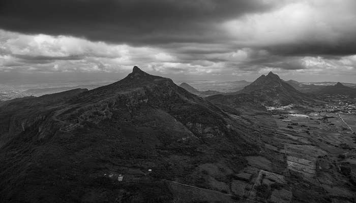
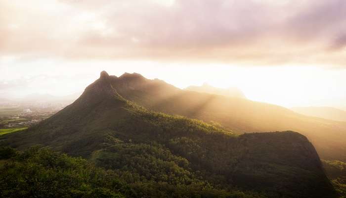
Le Pouce was first climbed by the great Charles Darwin in 1836. At 812 metres (2664 feet), Le Pouce is one of the most recognisable mountains in Mauritius. It features gently sloping sides culminating in a pointy peak resembling a thumb (pouce in French). This is the third-highest mountain on the island.
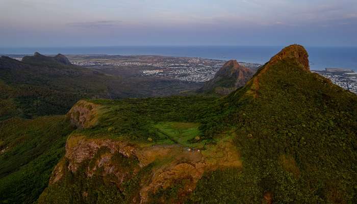
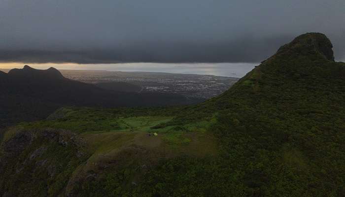
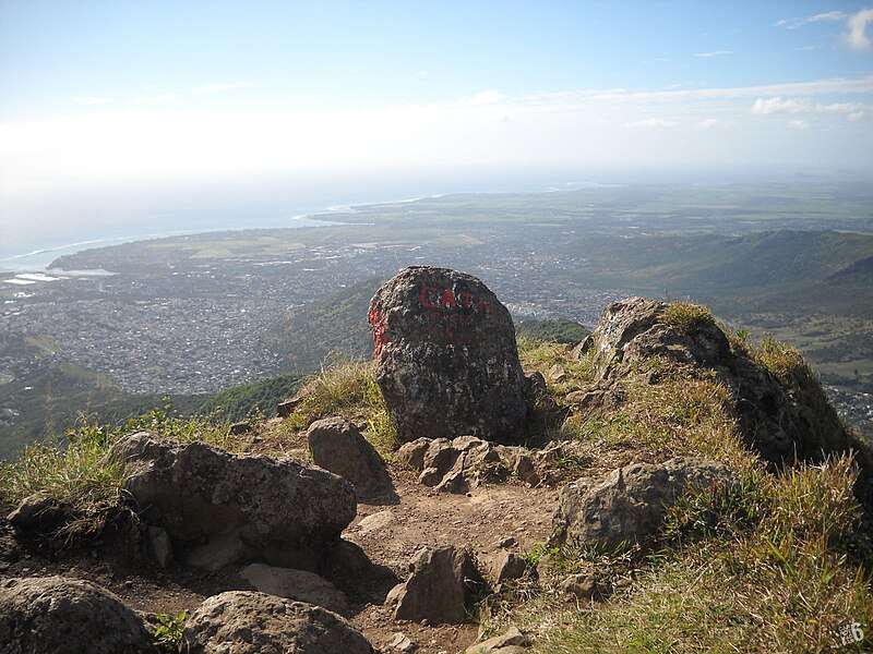
Views at the summit encompass the entire island. You will get diverse views of sugarcane fields, mild hills, mountains, and cities that stretch all the way to the glittering Indian Ocean. Going up there is an easy trek that occasionally involves some scrambling. Le Pouce is part of the Moka range. It is ideally situated for hiking in Mauritius. It is sandwiched between Pieter Both Mountain, which has a human head shape and Signal Mountain, which gets its name from a peak covered in aerials. Clear days allow views all the way to the little northern islands of Round Island and Snake Island.
Points to note: First climbed by Charles Darwin, Easy hike
Things to do: Hike, photography
Must Read: Photography Museum In Mauritius
2. Mountain Features And Facts
Mauritius is located in a volcanic belt called the Mascarene Islands. The Moka Range, produced by volcanic explosions 10 million years ago, has Le Pouce as its second-highest summit. The range is a dome of basalt lava that is no longer experiencing volcanic activity. The guava and acacia that overgrow Le Pouce are not indigenous to the area. However, they make the mountain lush and beautiful to look at. The Le Pouce Mountain Screwpine, or Pandanus Pseudomontana, is one example of indigenous flora found here.
Although this plant is not formally included on the IUCN Red List, the organisation may consider it critically endangered. Two plants in the Le Pouce Mountain Nature Reserve are the only specimens of this species. Because these are both male plants, there is an “extremely high risk of extinction” for this species.
Points to note: Pare fauna and flora are found here; it is an inactive volcano
Things to do: Photography, adventure travel, geographical study
3. Geographical Aspects Of Le Pouce
Just like its features, the geography of Le Pouce is equally enticing. Le Pouce was formed ten million years ago in a basalt lava dome. The mountain offers a so-called thumb-like projection, which rises close behind the town to a height of 2600 feet. At the platform’s centre is a cluster of remarkable broken basaltic mountains, with their strata dipping seawards. This platform is around 13 miles across.
On the exteriors, the bounding mountains make the range more beautiful. These come into that class of structures called Craters of Elevation, which are supposed to have been formed not like ordinary craters but by a great and sudden upheaval. There appears to me to be insuperable objections to this view: on the other hand, I can hardly believe, in this and in some other cases, that these marginal crateriform mountains are merely the basal remnants of immense volcanos, of which the summits either have been blown off or swallowed up in subterranean abysses.
Points to note: The mountain is at 2600 feet, comes under Craters of Elevation
Things to do: Travel, hike, trek
Suggested Read: Tamarind Falls
4. Le Pouce Mountain Hiking Trail
Le Pouce Mountain Hiking Trail has become a major attraction for travellers visiting Mauritius. You can begin your hike to the summit of Pouce from either Port Louis or St-Pierre (the one we suggest). If you are travelling without a guide, it can be challenging to locate the trek’s starting point. Pay attention to the road signs and don’t be afraid to approach the helpful locals for assistance if you ever feel lost. Starting from the M1 highway, head towards Moka.
On arrival, you will see a road sign that reads “Le Pouce / Nouvelle Découverte” around 150 metres after the Mont Desert Alma roundabout. Proceed in that direction and then take the first left. Then, at the entrance of a sugar cane road, you will find a small sign that reads “le Pouce” after about 1 km, 15 metres before the bend to your right. This is where you must turn and parking is available close to the houses in the hamlet or a little farther on, close to the hike’s beginning. Ten minutes on the road through the sugar cane fields will get you to the zigzag road on the mountain, where the hike truly begins, tucked beneath large trees and a dense forest. You will arrive at the treeless road at the cliff’s edge after going through the forest, which at this height already provides a fantastic view over the Plaine Wilhems mountains, over Pailles and over the harbour. You’ll need to make a right turn on a tiny route soon after in order to reach the summit of the mountain.
Points to note: Medium difficulty hike, follow the arrows
Things to do: Photography, hike
5. Things To Carry With You
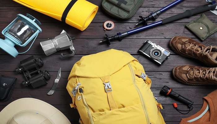
The hike to Le Pouce mountain may not be as easy as it seems. However, if you have the right stuff with you, you can make it easily and in time. Since you will ultimately need to rock climb, you should absolutely invest in a decent pair of trekking/hiking shoes. Thus, a pair of shoes with strong traction would be really helpful. Don’t forget to pack accordingly. During the hike, you’ll need a daypack to store your necessities, such as cash, food, snacks, water, a camera, etc.
Other essentials include water and food. There are no food or water stops along the route, so make sure you pack enough water and snacks. You may also want to carry a light jacket as it can become chilly at the summit. Moving on, it’s suggested to carry sunscreen and sunglasses. In Mauritius, you receive direct sunlight, which can be very damaging to your skin and eyes. Thus, to protect your skin, always wear a good pair of sunglasses and apply sunscreen. Lastly, don’t forget to carry your camera. You really don’t want to miss the view from the summit if you’re an avid photographer. Aim for breathtaking photos at the summit of the peak and make sure your camera batteries are charged in advance.
Points to note: Carry water and food, carry a thin jacket
Things to do: Hiking
Further Read: Goodlands In Mauritius
Le Pouce offers a once-in-a-lifetime experience. Visiting this mountain will help you witness the ethereal beauty Mauritius has to offer. Not only can you create good memories, but also head on to other nearby wild reserves. Also, don’t forget that the journey to the mountain itself is quite adventurous and full of thrills. So, plan your trip to Mauritius today and witness the Le Pouce mountain in all its glory.
For our editorial codes of conduct and copyright disclaimer, please click here.
Cover Image Source: Shutterstock
Frequently Asked Questions About Le Pouce
What is Le Pouce mountain height?
Le Pouce mountain height is around 812 metres that equates to 2664 feet of altitude. It is the third-largest mountain in Mauritius.
What is Le Pouce Mountain's Location?
The Le Pouce Mountain Location is the Moka Range of Mauritius. There are two starting sites to think about while beginning your Le Pouce hike. The ideal way is to start from the St. Pierre settlement, but you may also enter it from the opposite direction by taking Tranquebar. You would have to get to the village first if you went with the St. Pierre option. Quatre Bornes and Curepipe have multiple buses that can transport you to St. Pierre. The official bus website for Mauritius provides additional information on the route and bus number. After arriving in St. Pierre, the trek's beginning point, Petit Verger, is 1.5 kilometres away on foot.
Is Le Pouce Hard to Climb?
For experienced hikers, the mountain is fairly easy to climb. But for first-timers and usual travellers, there might be some form of challenges included, such as taking the wrong trails or the steep descent.
What is so special about Le Pouce?
Le Pouce was named on its shape, which represents the thumb. The mountain was first climbed by Charles Darwin. These facts make it special.
How long does the hike to Le Pouce take?
It is around 400 metres altitude gain. It may take anywhere from 1 to 2 hours for the entire hike to the mountain.
People Also Read:
Hiking In Mauritius Waterfalls In Mauritius Paragliding In Mauritius

Unveil the hidden treasures of the globe and turn every travel dream into reality. As a Content Writer, I am passionate enough to craft stories from ancient wonders to modern marvels. My words paint the picture-perfect itinerary for unforgettable experiences. Let my words be your trusted guide to immerse in the diverse culture and discover the beauty of the unknown.